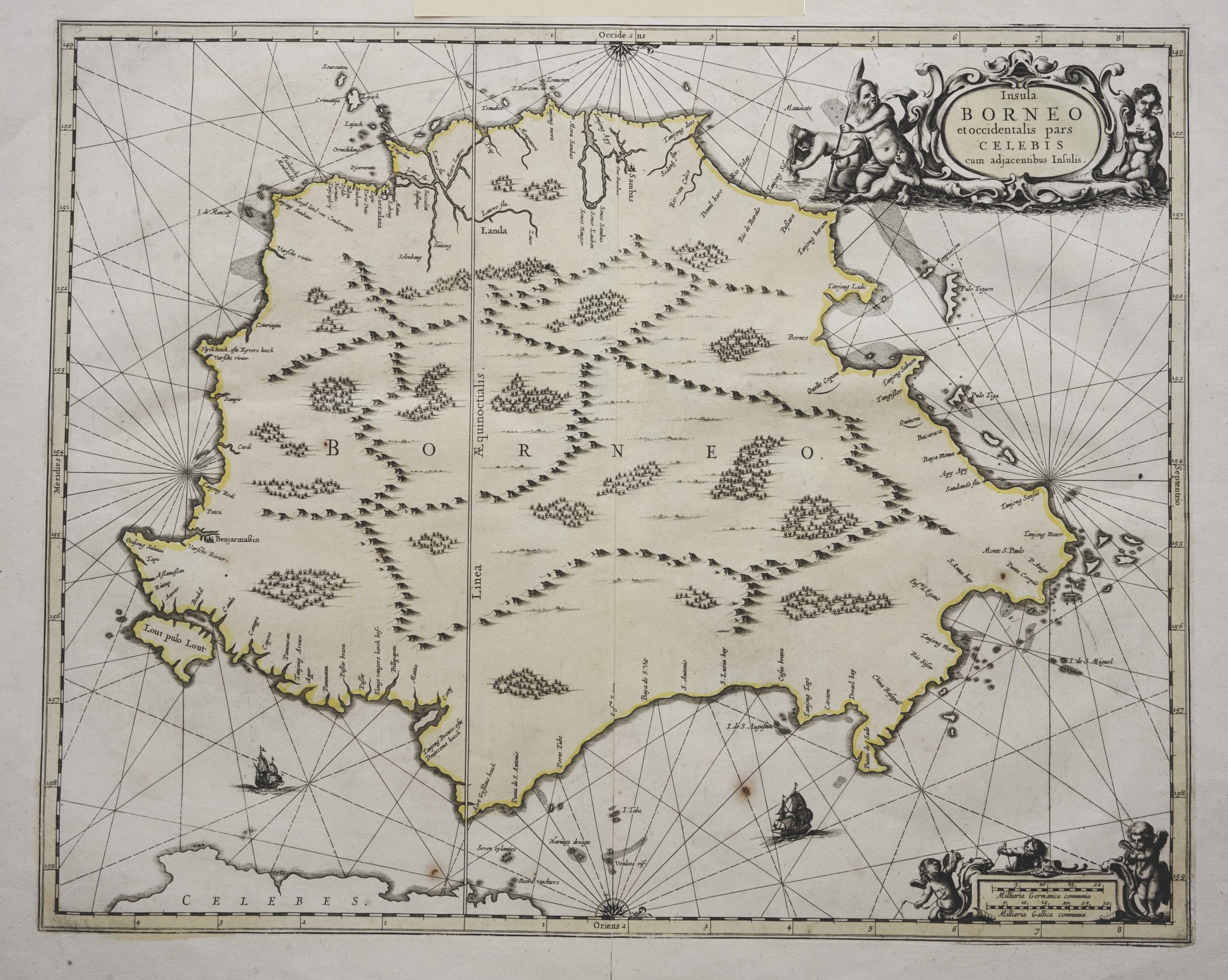
Sea Chart of Borneo – Janssonius (c.1657)
Janssonius · 1657
IDR 32,000,000
In our Jakarta gallery
- Maker
- Janssonius
- Date
- 1657
- Category
- Map
- Reference
- M1707
Titled “Insula BORNEO/et occidentalis pars/CELEBIS/cum adjacentibus Infulis”
A beautiful mid-17th century in old pastel colour sea chart of Borneo Island by the famous Dutch cartographer Jan Jansson also known as Johannes Janssonius (1588-1664) and published in his five-volume sea atlas
Atlantis Majoris Quinta Pars Orbem Maritimum in 1657. One of three-folio sized maps of the three largest Indonesian islands in the atlas, the others being Sumatra and Java. Contains illustrations of forests and mountains with 2 compass roses, sailing ships and ornate cartouche and scale bar.
Very good condition; apart from a brown spot in the lower part of the image and a margin tear on the centre fold
Measures 423 x 530 mm
- An original antique sheet, not a reproduction
- The actual piece is photographed
- Certificate of authenticity on request
- Viewing in Jakarta by appointment