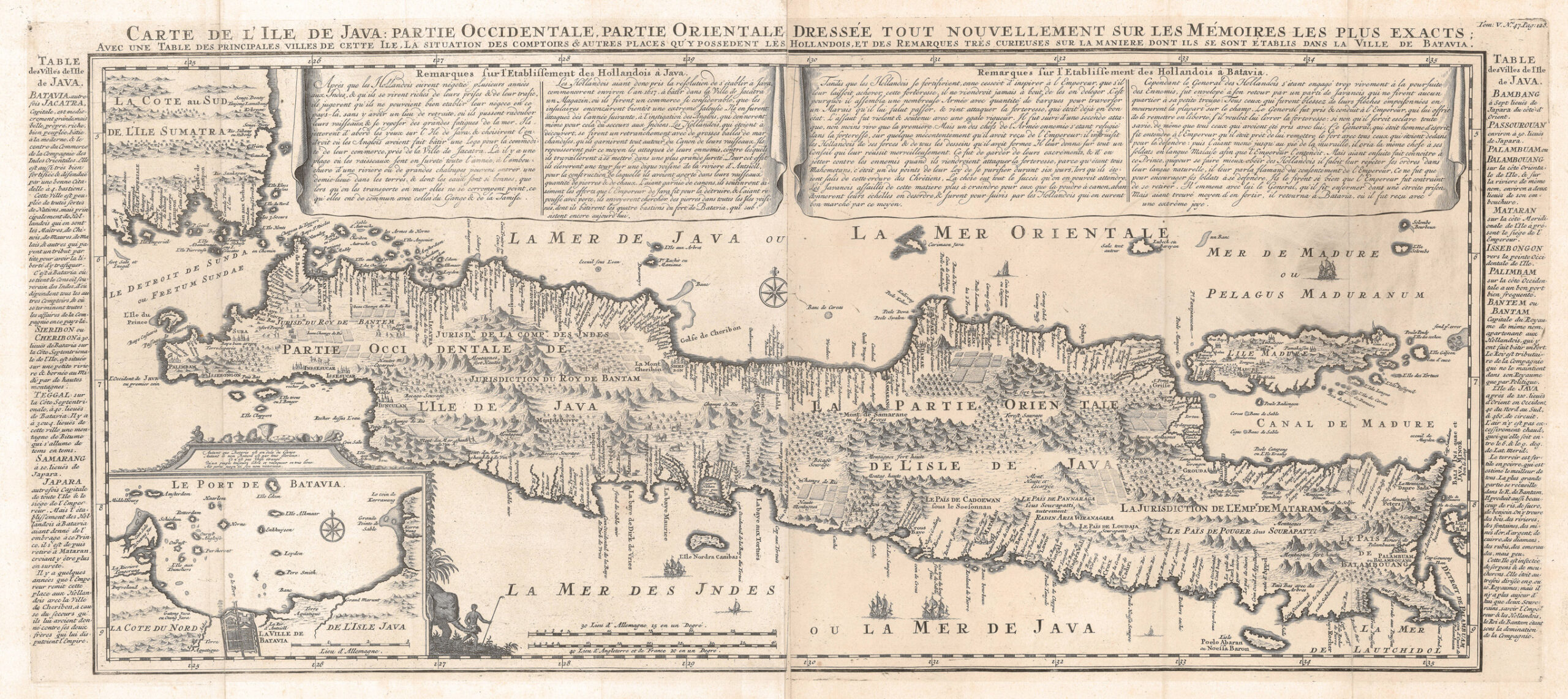
Antique Map Java by Chatelain (1705)
- Maker
- Chatelain
- Date
- 1719
- Category
- Map
- Reference
- (BGW) M0183
Antique Map Java by Chatelain titled ‘
CARTE DE L’ILE DE JAVA : PARTIE OCCIDENTALE, PARTIE ORIENTALE, DRESSÉE TOUT NOUVELLEMENT SUR LES MÉMOIRES LES PLUS EXACTS;/
AVEC UNE TABLE DES PRINCIPALES VILLES DE CETTE ILE LA SITUATION DES COMPTOIRS & AUTRES PLACES QU’Y POSSEDENT LES HOLLANDOIS, ET DE REMARQUES TRÈS CURIEUSES SUR LA MANIERE DON’T ILS SE SONT ÉTABLIS DANS LA VILLE DE BATAVIA’.
The much sought-after large-scale black and white map of Java by the 18 th century French cartographer Abraham Chatelain (1684-1743) and published in Volume V of the
Atlas Historique between 1705 and 1720. The map, modelled on Hadrien Reland’s earlier map that was also the source for Gerard van Keulen’s chart of Java published in 1728, was printed as two separate sheets labelled west (Occidentale) and east (Orientale) that are generally joined to make a complete map of the island. The map has an inset of the Port of Batavia and the off-shore islands (The Thousnad Islands) in the south-west corner and contains extensive notes on the history and geography of Java that are included within the borders of the map and along the margins.
A good strong impression with wide margins in excellent condition apart from two 2 cm worm tracks in the upper margin and some paper browning and age-toning along the edges of the map;
Measures: 360 x 803 mm within map boundary.
- An original antique sheet, not a reproduction
- The actual piece is photographed
- Certificate of authenticity on request
- Viewing in Jakarta by appointment