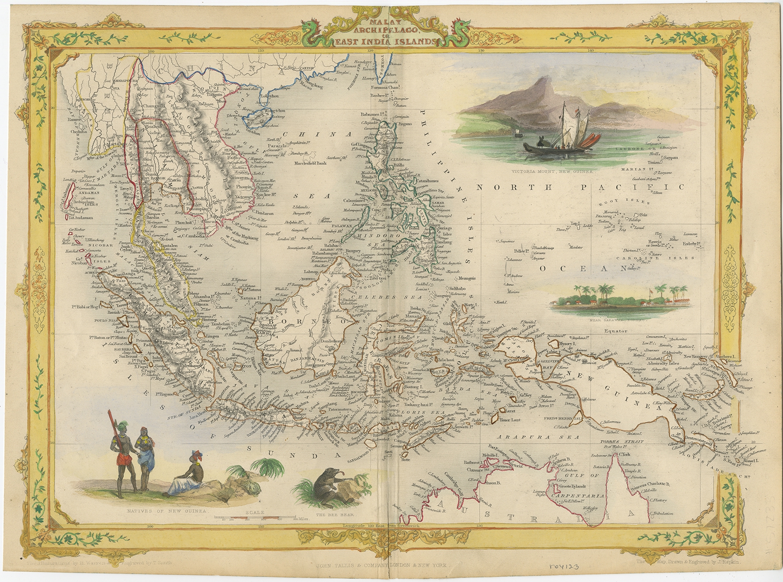
Malay Archipelago or East India Islands – Tallis (c.1851)
- Maker
- Tallis / John Rapkin
- Date
- 1851
- Reference
- BG-11613
Antique map Indonesia titled ‘Malay Archipelago, or East India Islands’. With vignettes of Victoria Mount, New Guinea, Nativaes of New Guinea and scenes near Sarawak, Borneo. Originates from ‘The Illustrated Atlas, And Modern History Of The World Geographical, Political, Commercial & Statistical, Edited By R. Montgomery Martin’. Published; John Tallis London, New York, Edinburgh & Dublin. 1851. Drawn and Engraved by J. Rapkin.
Artists and Engravers: John Tallis (1817-1876) was a British map publisher. Born in the Midlands, Tallis came to London in the 1840s. Tallis began his London career with a series of remarkable London street views. He began a partnership with a Frederick Tallis, possibly his brother, but their collaboration ended in 1849. For the Great Exhibition of 1851, Tallis published the Illustrated World Atlas, one of the last series of decorative world maps ever produced. The maps were engraved by John Rapkin, a skilled artisan. The maps were later reissued by the London Printing & Publishing Company, who left the Tallis imprint intact, thus ensuring his enduring fame. In 1858, he began publication of the popular Illustrated News of the World and National Portrait Gallery of Eminent Personages, selling it in 1861 (it ceased publication in 1863).
Date: c.1851
Overall size: 36 x 26.5 cm.
Image size: 34 x 25 cm.
Condition: Good, age-related toning. Few minor defects, Please review the images for further condition details.
- An original antique sheet, not a reproduction
- The actual piece is photographed
- Certificate of authenticity on request
- Viewing in Jakarta by appointment